


5 of the Best Mt. Rainier Hikes
Written by Halley Sherwood


If you know me, you know that Mt. Rainier was one of my first loves. It’s the first place I went hiking without my parents, and it’s the awe-inspiring mountain I get to see nearly every day in my home state of Washington. I’ve done more hikes than I can remember in this park, so it feels really hard to pick 5 of my favorites, but here we go!

Where is Mt. Rainier?
Mt Rainier, also known by its native name Mt. Tahoma or təqʷuʔmaʔ, is located in the middle of Washington state, in the land of the Cowlitz, Muckleshoot, Nisqually, Puyallup, Squaxin Island, Yakama, and Coast Salish peoples.
The nearest town on the Paradise/Longmire side of the mountain is Ashford, with Greenwater, WA being the nearest town on the Sunrise side.
How to get there
There are two distinct sides of Mt. Rainier: Paradise/Longmire and Sunrise. Both entrances have their own visitor’s center with bathrooms and gift shops. During the winter (and often even into early summer) the Sunrise side of Mt. Rainier is closed to the public due to intense snowpack.
The Longmire side of Mt. Rainier is open year-round, although it’s important to pay attention to when the gates to Paradise Visitors Center open and close. (Also worth noting that due to COVID and limited staffing, the park has been subjected to a change in hours. At one point this year, the gate to Paradise was only open on the weekends).
You will need to purchase some sort of entry pass to get into Mt. Rainier, whether it’s an annual America the Beautiful pass ($80), an Annual Mt. Rainier pass($55), or a day pass ($30). You can usually do so at the entrance gate, although you can purchase these passes online in advance as well. (Also, the entrance gate usually only accepts credit or debit, no cash!)
What to bring
Since I was a kid, my stepdad stressed the importance of carrying ‘the 10 essentials’ with me at all times while on the mountain. The 10 essentials include:
Nutrition (always pack more food than you think you need, you never know if that 2.8 mile hike could accidentally turn into a 8.2 mile hike!)
Hydration (another thing to always pack extra of! Bonus points if you bring electrolytes like Liquid IV or Nuun)
Navigation (map, gps, compass, etc)
Sun protection (sunscreen, hat, full coverage clothing, sunglasses)
Insulation (layers are key on the mountain!)
First Aid (duh! I carry around this one)
Illumination (flashlights or headlamps in case you end up hiking in the dark. Again, things happen!)
Fire (Matches, lighter, firestarter, etc)
Minor Tools (paracord, scissors, knife)
Emergency Shelter (tent, space blanket, tarp)
I’ve gotta admit I had to google this list to figure out what the last 3 essentials were, so that tells you how good I am at bringing those 😅. And then I have to admit once more that I am 100% guilty of not bringing the 10 essentials with me on every hike. That being said, I try to do my best to make sure I’m as prepared as possible for the most common emergency scenarios that could happen (inclement weather, injury, getting lost)
One thing that somehow isn’t on the 10 essentials list– but absolutely should be!-- is bug repellant!! During much of the summer time, the Washington nature scene is rife with mosquitos, my #1 enemy. Many pro hikers will even tell you that bug spray alone won’t do the trick, it’s encouraged to bring a mosquito net for your head!!
1. Burroughs Mountain Loop Trail (view on AllTrails)
Distance: 9.5 miles
Elevation: 2,601ft
Type: Loop
Difficulty Rating: Hard
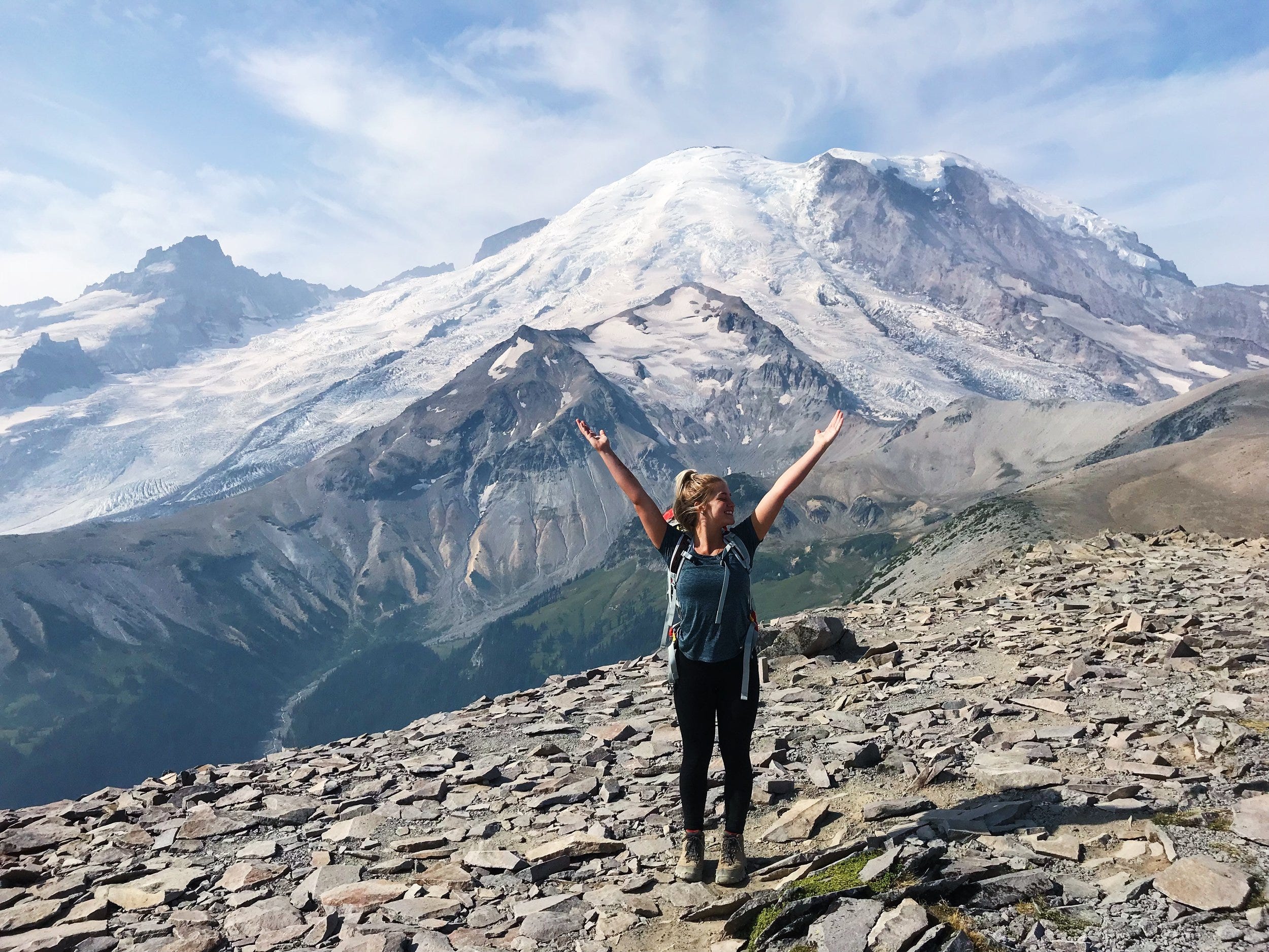
This was the very first hike that my best friend and I ever did by ourselves, and still the one I look back on most fondly.We were maybe 17 years old and woke up super early to drive to the Sunrise side of Mt. Rainer (Tahoma). We thought the hike was only supposed to be 4 miles roundtrip, a 'moderate' on AllTrails, LOL. About 4 miles ONE WAY and 1300+ ft of elevation later, and through the most biting wind chill I've ever experienced, we made it to the second-- not quite the third 😅-- burrough.
Even though it was a rough first ‘solo hike,’ seeing the absolute magnificence of this mountain so close was the most amazing experience I'd had in nature up to that point. There's really nothing like it. That was the first time I had the feeling of 'I am so small,' the feeling that I think every nature-lover is always chasing.
To this day, this is probably my favorite hike I’ve ever done at Mt. Rainier, and I couldn’t recommend it more! Pack sunscreen, appropriate layers, and lots of snacks and water!
2. Tolmie Peak Fire Lookout (view on AllTrails)

Distance: 5.6 miles
Elevation: 1,555ft
Type: Out and back
Difficulty Rating: Moderate
A Mt. Rainier classic! Tolmie Peak is the perfect combination of beautiful, calm, nature walk, plus a very daunting look up at the fire lookout you have to climb to and a big spoonful of switchbacks. This was the first hike I did where I was thinking, “We have to get all the way up there??” That being said, it’s a much more manageable trek than it looks, and the view at the top makes it all worth it! You can climb up to the majestic fire lookout and–weather permitting– see a perfect shot of Mt. Rainier with a teal alpine lake in front of it. A true stunner!
One important thing to note: there is no bathroom at this trailhead, so be prepared! Pack it in, pack it out!
3. Dege Peak (view on AllTrails)
Distance: 2.8 miles
Elevation: 807ft
Type: Out and back
Difficulty Rating: Moderate
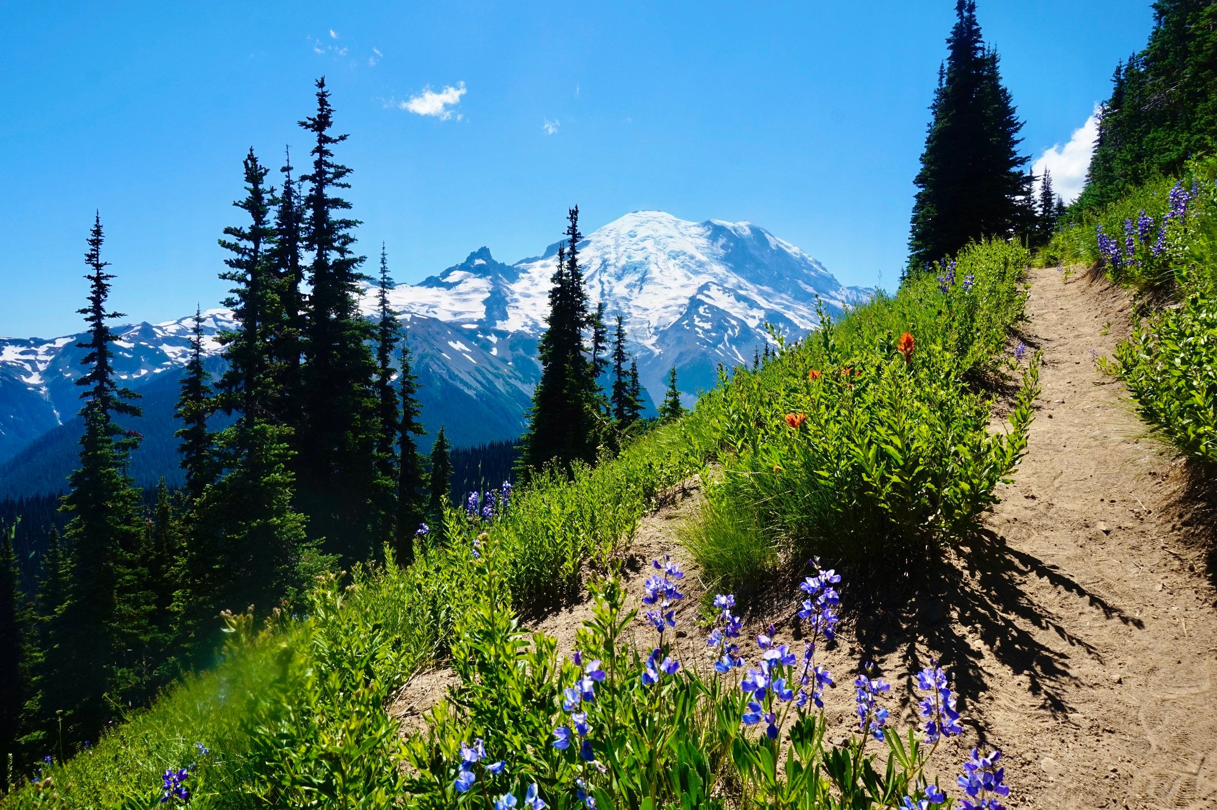
I absolutely loved this trail, mainly because it was short and sweet but still had INCREDIBLE views of Rainier! If you’re new to hiking– or just looking for something on the easier side– this is the trail for you!
Bring bug spray! I remember arriving to the parking lot of this trail, seeing the mosquitos in the air outside, and suddenly realizing I’d left our bug spray at home 😅. Thankfully, a kind stranger let us spray up with his bug spray, otherwise I think I would’ve sprinted up and down this trail (or turned around and went home??)
Depending on what time of year you go, this is also a great trail for catching the wildflowers and butterflies! Couldn’t recommend Dege Peak more!
4. Mount Fremont Fire Lookout via Sourdough Loop (view on AllTrails)
Distance: 5.7 miles
Elevation: 1,108ft
Type: Out and back
Difficulty Rating: Moderate
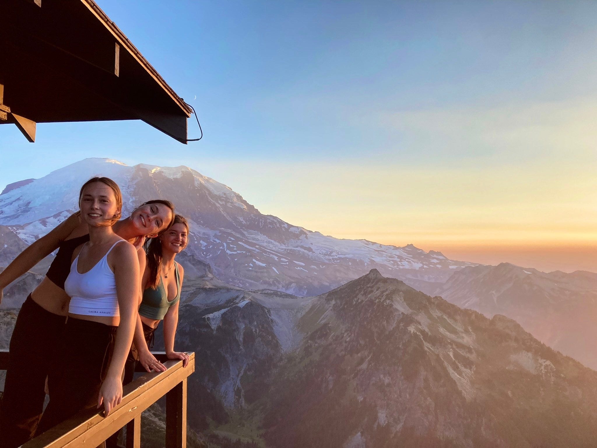
If you’re looking for the ultimate sunrise or sunset hike, I truly believe this is the one. Mount Fremont Fire Lookout is a moderate 5.7 miles roundtrip with very little shade throughout the whole hike, which is why I’d say to do it in the early morning or late evening to beat the heat. The 360 degree views from the fire lookout are hard to beat! If you do go for sunrise or sunset, bring a head lamp and some extra layers– it gets cold and windy when the sun goes down!
5. High Rock Lookout (view on AllTrails)
Distance: 3.2 miles
Elevation: 1,328ft
Type: Out and back
Difficulty Rating: Hard
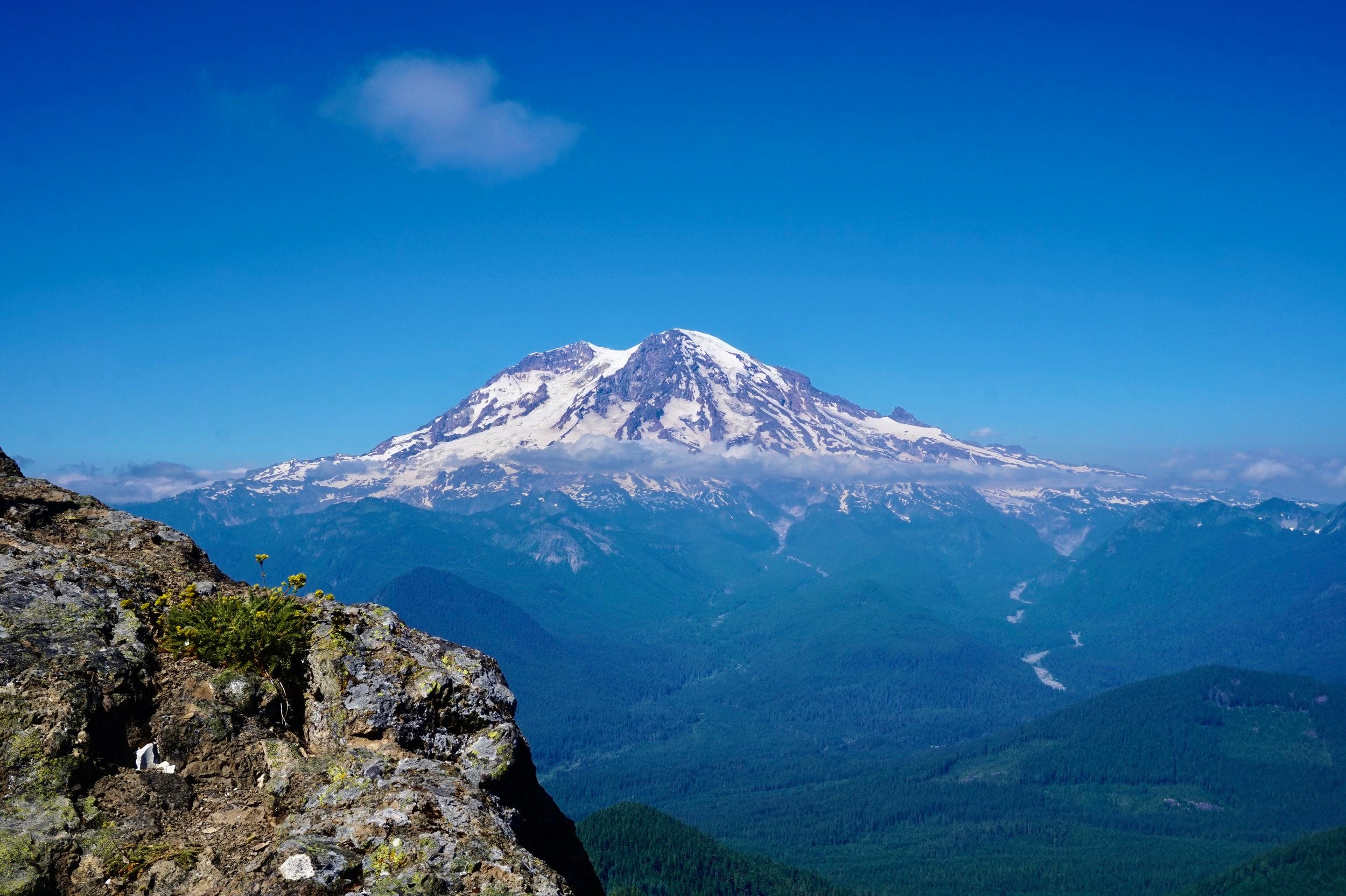
Although this hike is technically outside of Mount Rainier National Park, the amazing view of THREE Washington mountains– Rainier, St. Helens, and Adams– makes High Rock Lookout the last but not least amazing trail on the list!
Don’t let the mild mileage fool you though, the somewhat intense amount of elevation gain over a short distance gives this trail a ‘Hard’ rating– you’ll definitely feel the burn! This is another hike where I highly recommend bringing bug spray.
Conclusion
All in all, there are SO many amazing hikes at Mt. Rainier, these 5 just happen to be my all-time favorites. I highly recommend checking these ones out, as well as all the other incredible Mt. Rainier hikes!
The most important thing—no matter where you are— is to practice Leave No Trace principles so that we can all keep places like this as beautiful as they were when we got there!
Follow me on Instagram (@wanderwithhalley) to keep in touch and stay tuned for any future Mt. Rainier hikes I end up wandering through (:
 | A guest post by
|